Information
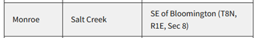
Names: Salt Creek, maybe?
Location: Southeast of Bloomington generally
County: Lawrence (according to my topo find), but Monroe (according to Forest Service lookouts page)
Topo quad: Bedford 1:62500 1937, Bedford 1:48000 1934
Condition: Not standing
Maps of Salt Creek tower site
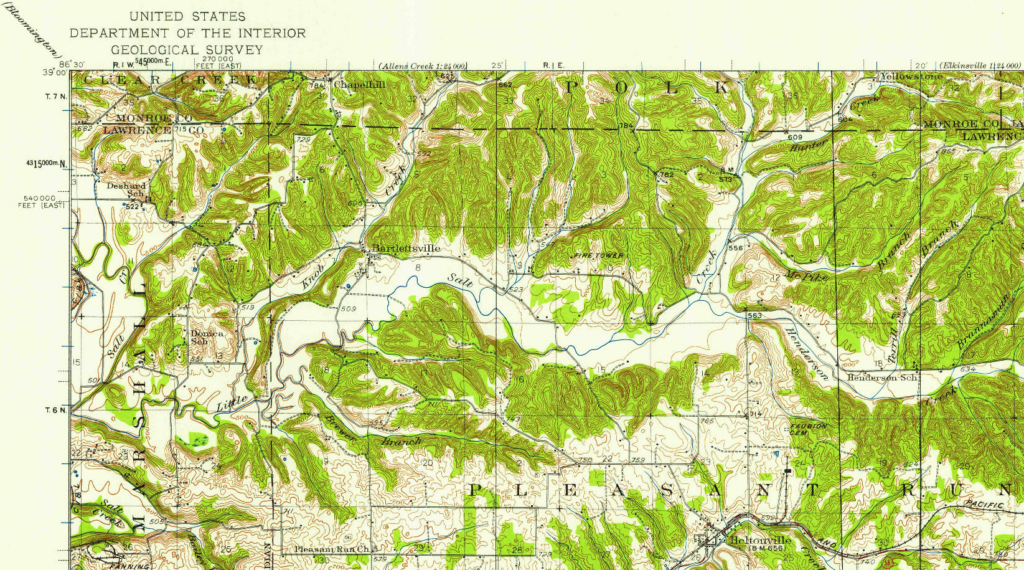
Bedford 1:62500 topo quad, 1934
Notes about this mystery
This one is a bit of a mystery. My topo research doesn’t match an official source.
My Salt Creek find
I looked at a lot of topos online, looking for the above, and found a tower at a different place further south. A “FIRE TOWER” appears on both the Bedford 1934 1:48,000 map and the Bedford 1937 1:62500 map. The site is east of Bartlettsville and north of Heltonville, in Lawrence County.
A fire tower appears on the 1934 larger Bedford Quadrangle map but not exactly where the Forest Service page mentions. It appears in Lawrence County, just south of Monroe County. This appears just north of Little Salt Creek due east of Bartlettsville. I have to guess that tower I found is Salt Creek.
But no tower appears in this location on the 1958 Bartlettsville 1:24000 topo. That suggests to me that this tower was there in 1934 and 1937 but gone by 1958.
The location I found in the map above would have been inside the Pleasant Run Unit boundaries. But so would have the the Section 8 location.
Just the name Salt Creek could refer to a wide area east of Bloomington, as there are three forks and the main Salt Creek itself, so it doesn’t pinpoint things very well.
Forest Service page: Salt Creek
The Forest Service lookouts page mentions Salt Creek but I could never find it on any 1:24000 topos at the location mentioned.
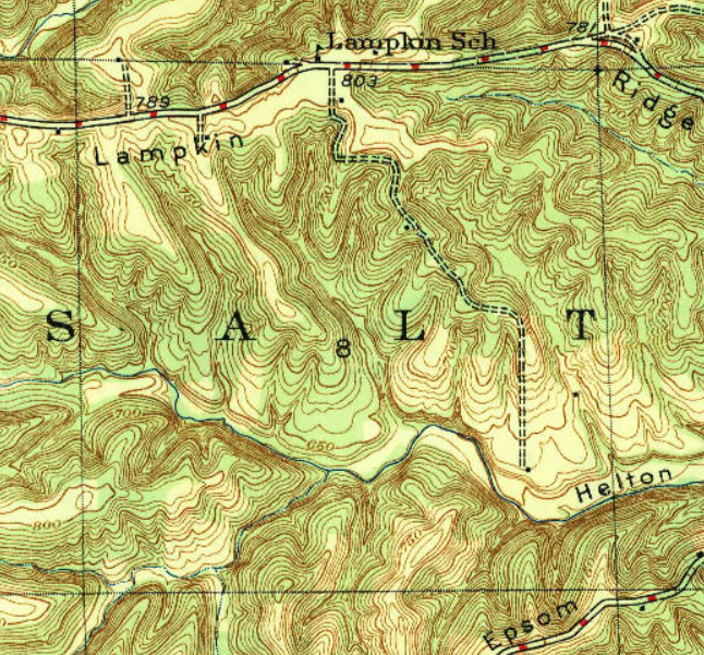
T8N R1E Section 8 would be east-southeast of Bloomington, near Lampkin Ridge, and would appear in the Unionville topo. There’s no tower there in the 1947, 1957, or later versions. Granted, just because it’s not on a topo, doesn’t prove it wasn’t there at some point.
There’s no tower here.
Data for the Salt Creek site
| Coordinates | Latitude | Longitude |
| Mine guessed from old 1937 topo (unofficial) | 38.971423 | -86.401958 |
History of Salt Creek tower site
The 1934 Division of Conservation annual report says that eighty-foot steel towers have been placed in a few places including “one near Heltonville, Lawrence County”.