Bonus content: This page is not about fire towers. It’s a collection of trail maps and other maps of Brown County State Park and Nashville. But the Weed Patch tower at BCSP shows up in most of these maps.
Most of this content comes from Indiana State Library Digital Collections website here. Credit: Indiana Division, Indiana State Library. I just wanted an easier way to browse this content.
What’s changed over time?
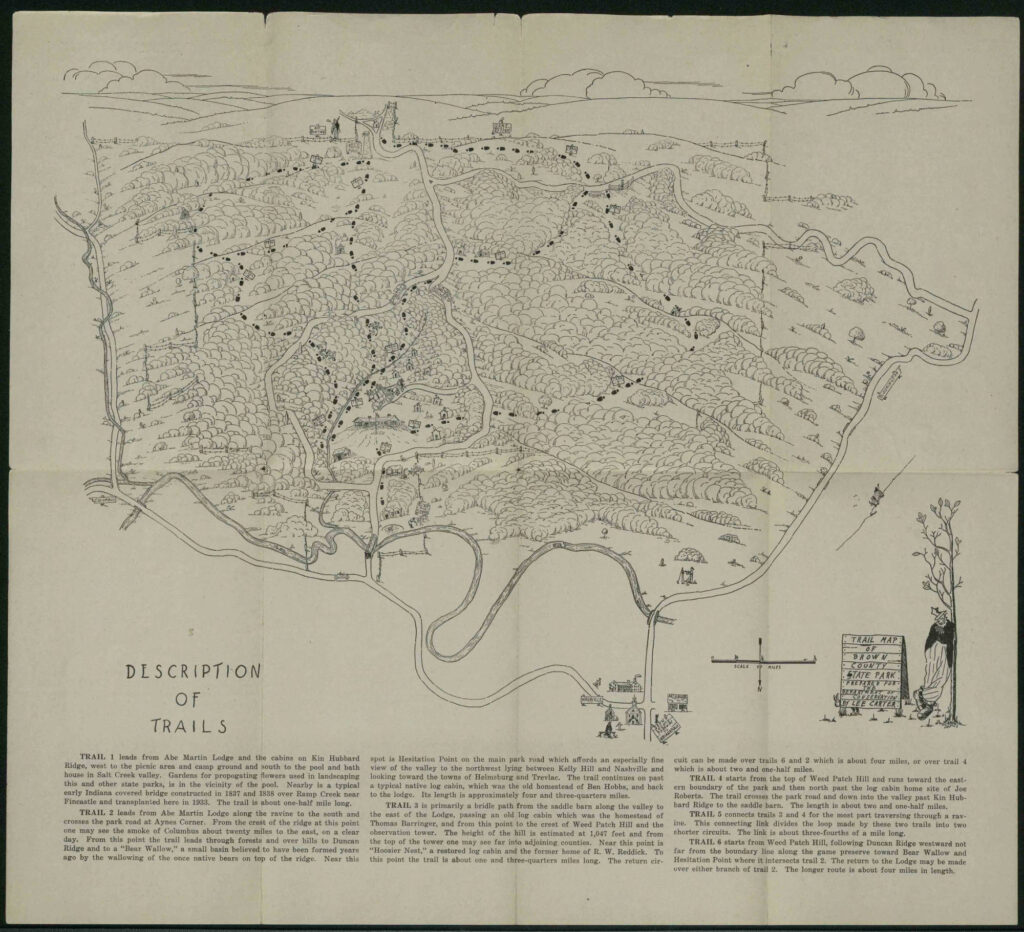
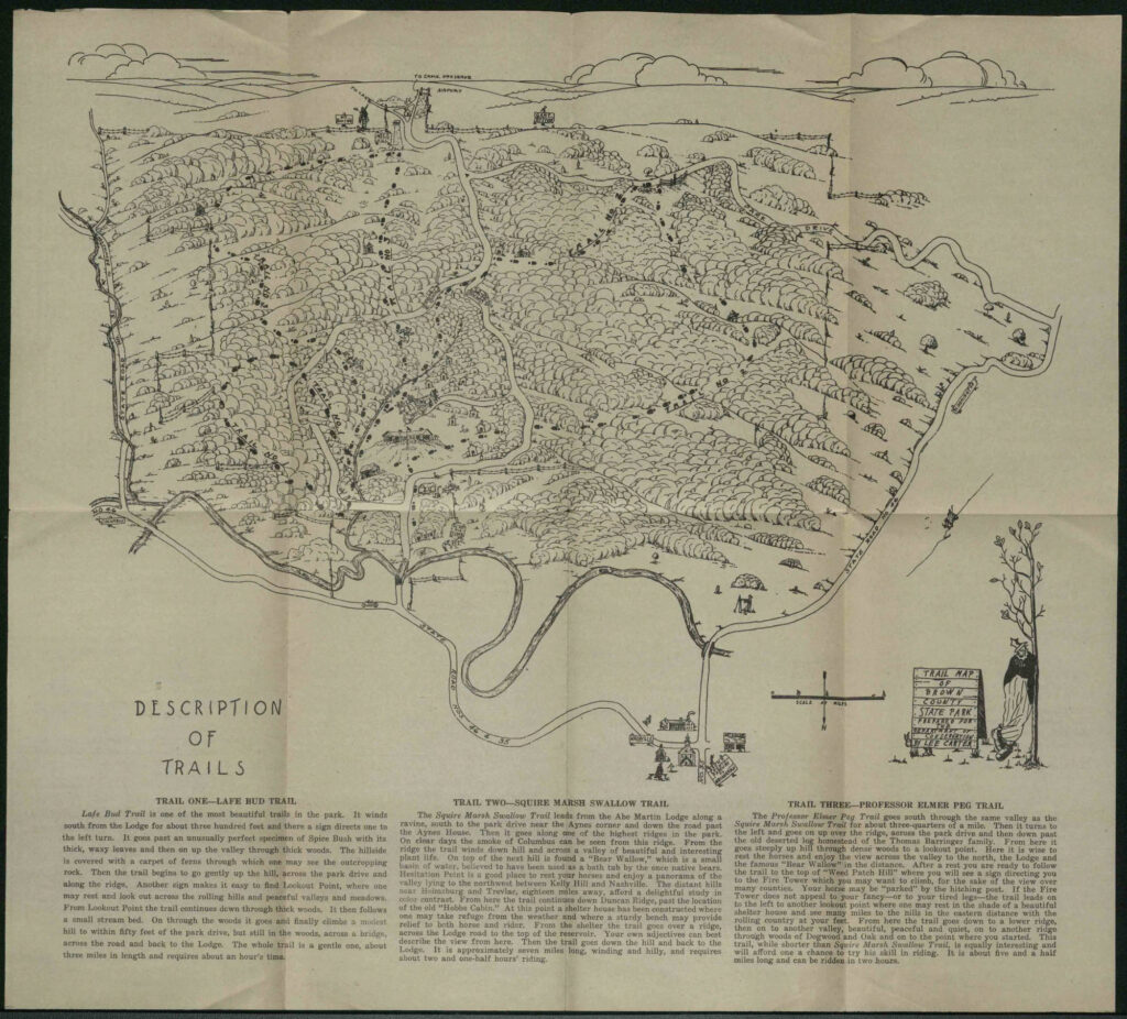
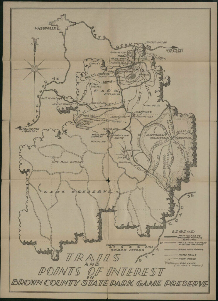
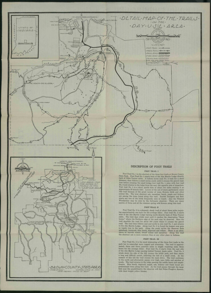
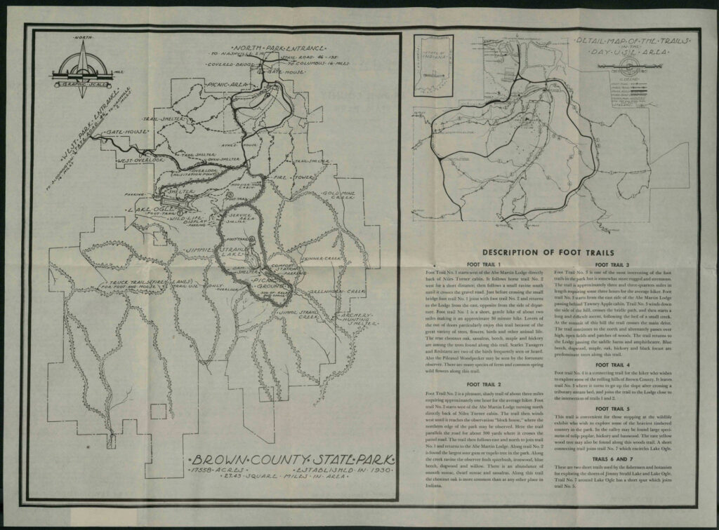
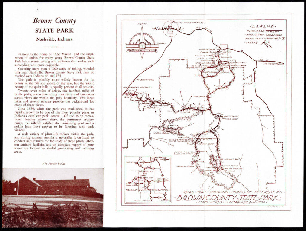
First of all, the trails at Brown County State Park have changed. In particular trails 1, 2, and 3 around the Abe Martin Lodge have changed a lot over the years. There are also long-gone trails like the one from the Lodge to the fire tower, which one can still find remnants of if you know where to look.
Locations of overlooks/vistas have changed too. As trees have grown in over the past 100 years, presumably some locations that used to have overlooks no longer provide good vistas.
Paved roads: For example the road down to Ogle Lake is paved today, but doesn’t appear as paved in all the old maps. Same with the southern loop.
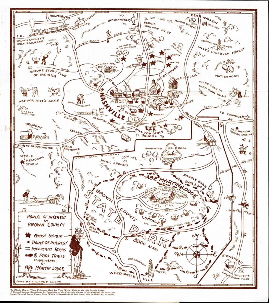
Highways: You can also see that IN-46 on the east side of Nashville has changed; it used to come right into the heart of town. IN-135 was known as IN-35 in the early 30s.
Activities: There used to be a big part of the park that was dedicated to archery. Obviously there weren’t mountain bike trails in the old days.
Airport appears for a while, near the fire tower, on Weed Patch Hill.
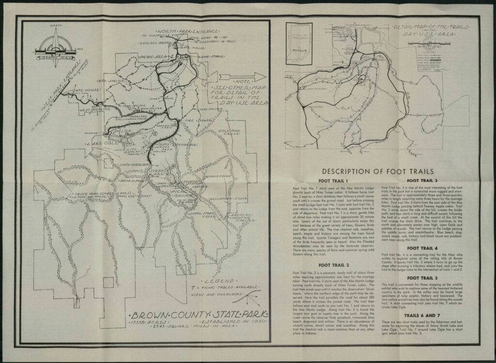
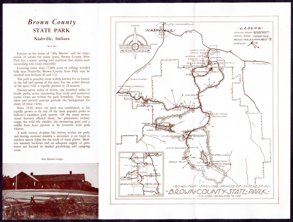
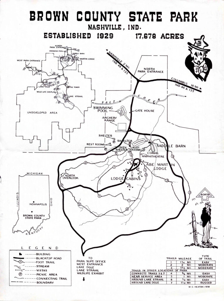
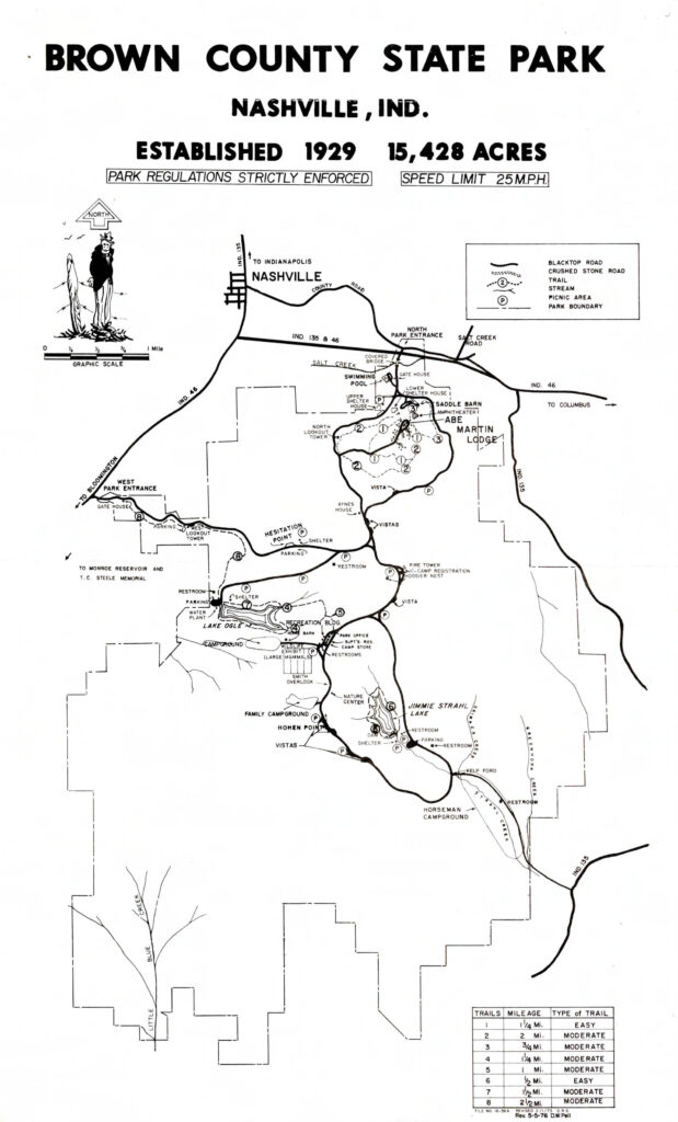
1930s
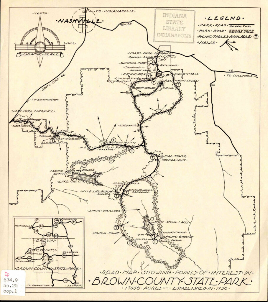
Personally I love the Nashville map above, but I don’t necessarily trust that the footprint paths accurately describe the trails at the time; who knows!
1940s
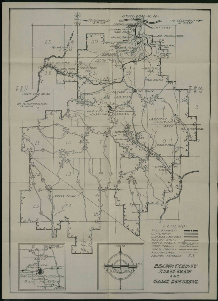
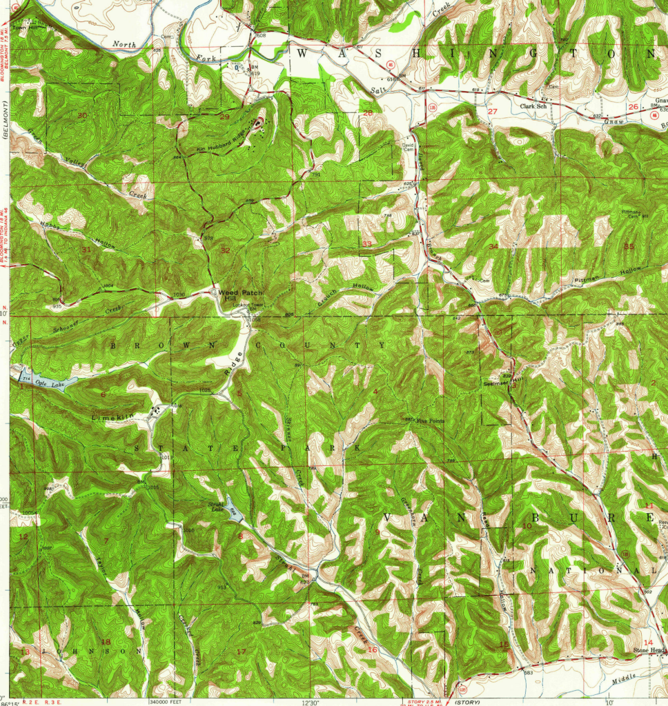
The above is an excerpt of the 1947 topographical map. Trails don’t appear, but there are lines that may be dirt roads, horse trails, forest roads, or other pathways, some of which mirror horse trails of today especially around Five Points in the east.
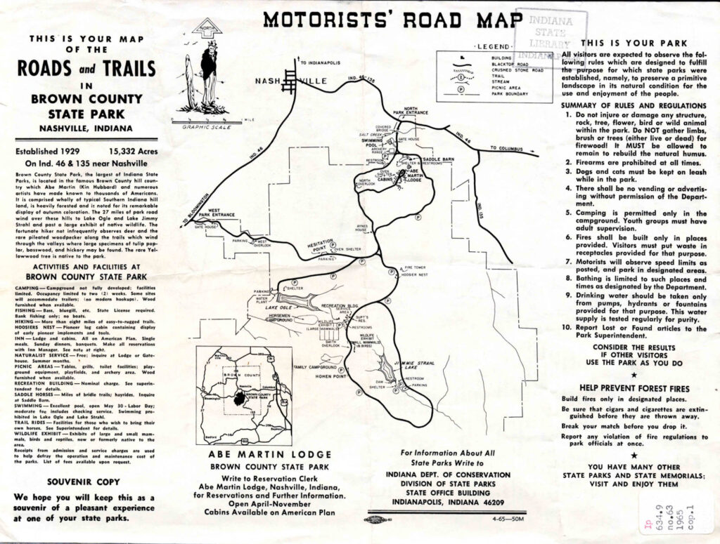
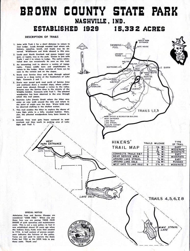
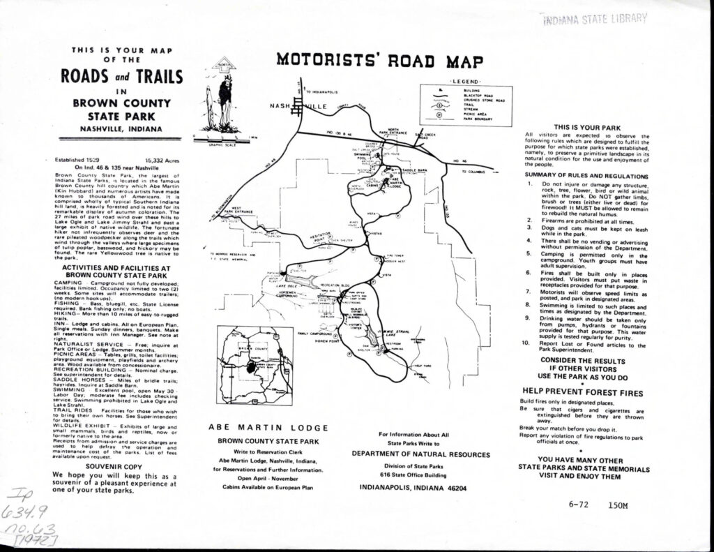
1950s
1960s
1980s
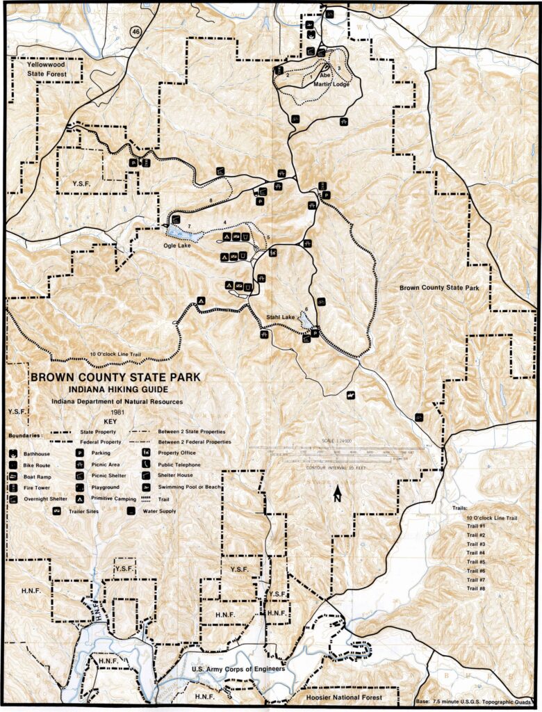
One thing I find interesting in this 1980-1981 map is the old Ten O’ Clock Line Trail, and that the map is specific enough to show exactly where that trail was. On the west side of this map, the 10 O’ Clock trail is what is the mountain biking L trail on Taylor Ridge today. But further east, it shows a trail that goes from near Hohen Point down to the southern end of Strahl Lake, which is not any known trail today. (This is one of the maps from an IDNR Indiana Hiking Guide. More info about this guide.)
This 1981 map above shows the modern arrangement of trails 1-3 around Abe Martin Lodge.
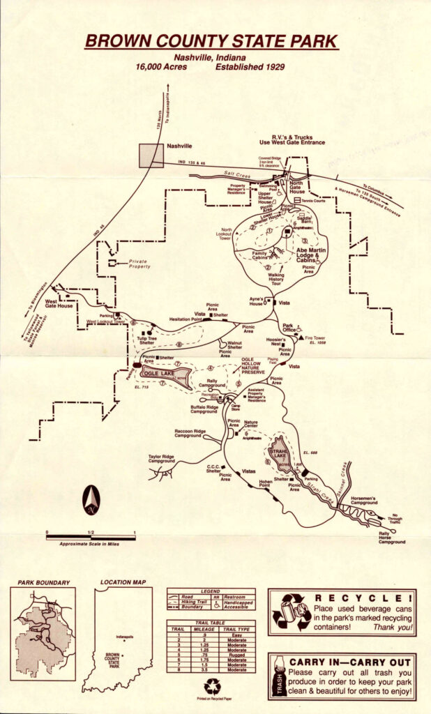
In this 1988 map, I note that:
- trail 9 (or 11) south of Ogle Lake doesn’t exist yet;
- trail 10 east of the fire tower doesn’t exist yet;
- trail 2 south of the Lodge is described as “Walking History Tour”; later maps show this legend in a slightly different place
- trail 8 is just one loop instead of the two loops it is today;
- there are no mountain bike trails.
2010s
Below: Scans of paper maps I have from 2014, 2016, and 2017.
Notes from this decade of maps:
- Trail 10 east of the fire tower exists, along with the Friends and Discovery trails;
- Trail 9 is the number for the whole trail system south of Ogle Lake; this will later turn into 9 and 11
- More and more mountain bike trails
- 2014 map: mountain bike trails A-I
- 2016 map: mountain bike trails A-L
- 2017 map: mountain bike trails A-M
2020s
Note that some maps from this era have Hohen Point in the wrong place.
Below: scans of paper maps from 2020 and 2023.
Below is a recent PDF of the BCSP official map.
Vistas in 2025
The current Seven Vista Challenge has these 7 vistas:
- West Lookout Tower Vista (facing west)
- Hesitation Point Vista (facing north/northeast)
- Friends Trail Vista (facing northeast)
- Weed Patch Hill Vista (facing south)
- Nature Center Vista (facing east)
- CCC Vista (facing northeast)
- Hohen Point Vista (facing north/east/south)
Check out their site and map.